Designed by Jon Matthews Copyright John Matthews 2010
Winscombe Archaeology
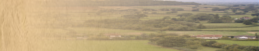
The lidar image also revealed that Outer Horseleaze was originally much larger, extending further to the north and west. This is indicated by the lines of the mediaeval field system and present field boundaries. The northern boundary of the field lies on what is almost certainly a pre-historic trackway that can be traced from Rowberrow, passing to the south of the large barrow, where it is called Philfare Lane. (An early date for this lane can be postulated as there is a clear ‘causeway’ connecting the barrow to the lane). The line can be followed along field boundaries to the north of Star and then west along a low escarpment to meet Shipham Lane.
The eastern boundary of Outer Horseleaze was probably Horseleaze Lane, a continuation of the line Mapleton Lane which passes close to the Roman villa at Star to the north. This suggests that this road was in use in Roman times and would appear to be confirmed by the location of a large coin hoard (Somerset HER 15266) in the angle between the two roads. This road would appear to continue south with a few deviations to join Shipham Road near Lillypool Farm.
It is clear that the present crossroads between the line of the A38 and Shipham Lane/Broadway cannot have exited in its present position until after the ridge and furrow was no longer in use, but it must have been located here at the time White’s map was drawn in 1792. If Broadway was a relatively recent road (post mediaeval) an earlier road must have connected Woodborough and Sandford with Shipham by another route to avoid the field systems.
The most likely routes would have been south from Shipham Lane at ST 4260 5832 where it would pass close to Paddington House and Winterhead, or along Hillyfields to Winterhead. The former route passes through a field once called Blunderhedge which has evidence of earthworks. It could be postulated that perhaps this is an indication of a small settlement, abandoned in the middle ages, thus leaving the arable land associated with it available for a different road system to develop.
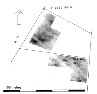
An interesting feature was revealed during the survey work in Outer Horseleaze. This was a circular area of high resistance about 35m in diameter with some indication of a surrounding ditch. It was tentatively identified as a ploughed-out round barrow as it is on the crest of a ridge with commanding views of the valley to the west. The northern ditch of the Roman road disappears as it cuts this feature. It is suggested that the barrow existed as a low mound at the time the agger of the road was constructed, the northern side of the road cutting across the edge of the barrow. The ditch would then have been lost as the barrow was ploughed away during later cultivation.
An interesting feature was revealed during the survey work in Outer Horseleaze. This was a circular area of high resistance about 35m in diameter with some indication of a surrounding ditch. It was tentatively identified as a ploughed-out round barrow as it is on the crest of a ridge with commanding views of the valley to the west. The northern ditch of the Roman road disappears as it cuts this feature. It is suggested that the barrow existed as a low mound at the time the agger of the road was constructed, the northern side of the road cutting across the edge of the barrow. The ditch would then have been lost as the barrow was ploughed away during later cultivation.
A resistivity survey of the north part of Outer Horselease showing the parallel ditches of the Roman road. The surface of the road has been ploughed away. The large circular feature (an area of high resistance) close to the A38 may be the remains of a round barrow which has been partly built over by the road and then ploughed away, removing traces of the northern ditch at this point.